Coastal Flood Advisory: The Complete Guide
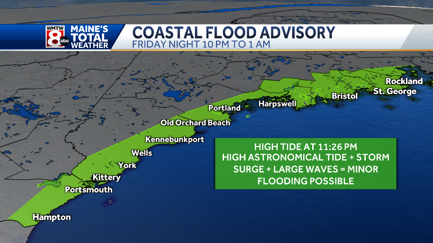
.jpg?format=jpg&quality=50&width=1920)
Quick definition
A Coastal Flood Advisory is an official alert (in the U.S., from the National Weather Service) issued when minor or “nuisance” coastal flooding is occurring, imminent, or likely. It’s less severe than a warning but still capable of causing disruptions—think flooded parking lots and low-lying roads near the shore, saltwater in storm drains, and splash-over in vulnerable spots. If people aren’t cautious, even “minor” flooding can threaten life or property.
Why coastal flooding happens
Coastal flooding isn’t just “water too high.” Multiple ingredients can push the sea inland:
-
Astronomical tides: Twice-daily highs can coincide with other factors.
-
Storm surge: The wind- and pressure-driven dome of water pushed ashore by tropical or extratropical storms. When surge stacks on top of high tide, you get a storm tide—often the worst case.
-
Persistent onshore winds & waves: Long-duration onshore flow piles water against the coast; wave runup pushes it farther.
-
Seasonal/long-term sea-level rise & “high-tide flooding”: In many places, unusually high tides now flood streets even on sunny days.
-
Rainfall runoff into tidal estuaries: Heavy rain can elevate water in bays and tidal rivers, compounding coastal inundation.
NOAA summarizes it succinctly: coastal flooding is the inundation of land along the coast, often intensified by high tides, onshore winds, and heavy rain.
Where advisories fit in the alert ladder
Think of advisories, watches, and warnings as a spectrum:
-
Coastal Flood Advisory → Minor flooding is happening or likely soon. Expect inconvenience and spotty impacts; act with caution.
-
Coastal Flood Watch → Conditions are favorable for significant (often moderate/major) coastal flooding within ~12–36 hours. Start preparing. (Criteria can be local—for example, water levels projected ≥ 2.5 ft above the minor-flood threshold in one NWS office.)
-
Coastal Flood Warning → Moderate to major flooding is occurring or imminent, often within 12 hours; take protective action immediately.
A general rule of thumb: Advisory = Be aware and cautious. Warning = Act now. Watch = Be ready.
What “minor” looks like on the ground
“Minor” (advisory-level) coastal flooding often means:
-
Ponding of saltwater on low-lying roads near the shore
-
Parking lots, parks, and lawns near the waterfront taking on water
-
Basements near the shoreline getting seepage
-
Splash-over at exposed seawalls; storm drains backing up
Recent local advisories typically call out impacts like up to ~1 ft of water over normally dry ground in vulnerable spots and the chance of brief road closures—small in depth, but enough to stall vehicles and damage property.
How forecasters decide to issue an advisory
Meteorologists blend observations and models to project total water level relative to local flood thresholds:
-
Tides (astronomical predictions)
-
Storm surge (wind + pressure)
-
Wave setup/runup (how breaking waves raise the near-shore water level and push it landward)
-
Freshwater inputs (runoff into bays/estuaries)
When that combined level is expected to exceed the “minor flood” benchmark for a given tide gauge or coastline segment, a Coastal Flood Advisory is likely. NOAA’s tools and local criteria guide these calls, and thresholds can vary significantly from one tide station to another.
Coastal Flood Advisory vs. other flood alerts
| Alert | Typical driver | Area | Lead time | Action |
|---|---|---|---|---|
| Coastal Flood Advisory | Tides, surge, waves, onshore wind | Shoreline/estuaries | Hours | Use caution; avoid low-lying shore roads |
| Coastal Flood Watch | Same, but larger/stronger event possible | Shoreline/estuaries | 12–36 h | Prepare property & routes |
| Coastal Flood Warning | Significant surge/tide/waves | Shoreline/estuaries | ≤12 h | Protect life/property now |
| Flood Advisory (inland) | Rain, poor drainage, small streams | Widespread or local | Hours | Be cautious; minor flooding |
| Flood/Flash Flood Warning | Rivers over flood stage / rapid runoff | Inland basins | Variable | Immediate action (flash flood especially) |
(NWS definitions emphasized that advisories denote less-severe but still hazardous conditions.)
Hazards you might underestimate
-
Driving through “just a few inches”: Saltwater hides dips, debris, and live electrical hazards. Vehicles can lose traction or stall quickly.
-
Soaked electrical systems: Saltwater is corrosive; it can ruin wiring, HVAC units, and elevator systems—damage that’s invisible until it fails.
-
Back-flow through drains: Tide-locked outfalls can send water back up into streets and basements.
-
Erosion: Even advisory-level events add to dune and berm erosion, weakening defenses before a bigger storm.
Practical steps: Before, during, and after an advisory
Before (days to hours ahead)
-
Know your local thresholds: Check your nearest tide gauge and local “minor flood” levels; monitor predicted high tides and surge forecasts. NOAA offers viewer tools for sea-level and inundation scenarios.
-
Protect ground-level assets: Elevate or relocate vehicles, electronics, generators, HVAC units, and chemicals above expected water levels.
-
Backflow & drainage: Confirm flap gates/backflow preventers work; clear curb inlets near your property.
-
Plan detours: Identify alternate routes that avoid low-lying waterfront roads.
-
Sign up for alerts: Local emergency/text alerts and NWS notifications keep you ahead of rapidly changing tide/wind timing.
During (as the advisory goes into effect)
-
Avoid flood-prone roads: “Turn Around, Don’t Drown” isn’t just for flash floods—saltwater can be deceptively deep.
-
Keep clear of seawalls & jetties: Wave splash and runup are stronger than they look; rogue waves can knock you into turbulent water.
-
Protect indoor air & power: Keep electrical panels dry; don’t touch wet electrical equipment; use GFCI where appropriate.
-
Mariners: Check harbor surge and waves; double-line moorings; add chafe gear; verify bilge pumps and shore power. (Local NWS marine pages often include harbor-specific guidance.)
After (when water recedes)
-
Treat floodwater as contaminated: Saltwater often carries fuel, sewage, and debris—use protective gear during cleanup.
-
Document first, clean second: Photo/video damage for insurance; don’t discard receipts or damaged items without records.
-
Rinse and neutralize: Salt accelerates corrosion—freshwater rinse metal components promptly; check vehicles and machinery for salt exposure.
-
Inspect utilities & structures: Have licensed pros check electrical, gas, elevators, and foundations before full re-occupancy.
How advisories intersect with infrastructure and planning
-
Stormwater systems: When ocean levels exceed outfall elevations, stormwater has nowhere to go—causing “sunny-day” flooding during high tides. Communities are adopting tidal valves, higher outfalls, and pump stations.
-
Roads & evacuation routes: Repeated nuisance flooding undermines pavement, corrodes rebar, and reduces reliability of critical corridors during larger events. Some agencies are now using tiered “coastal flood threat” matrices to communicate impact severity.
Mapping & codes: FEMA’s coastal flood mapping (Risk MAP) and guidance documents inform base flood elevations, breakaway wall requirements, and design wave heights—affecting building codes and insurance.
Coastal Flood Advisory in a changing climate
Two trends are reshaping what “advisory-level” means:
-
Rising baseline sea level → Today’s tides ride a little higher, so thresholds are crossed more often. High-tide flooding events are increasing in frequency in many U.S. coastal cities.
Compound events → Onshore wind + modest surge + high tide + basin runoff can add up. Modern guidance emphasizes total water level rather than just “surge” or “tide” alone.
Result: places that saw a handful of nuisance floods per year may now see them several times per season, stressing roads, businesses, and public services.
Special notes for different audiences
Homeowners & renters
-
Verify your flood insurance (standard homeowners insurance doesn’t cover flood).
-
Elevate important utilities; consider flood vents and deployable door dams if you’re repeatedly impacted.
-
Keep a simple “waterline kit”: sandbags or water-filled barriers, duct tape for door sweeps, plastic sheeting for vents.
Small businesses
-
Protect point-of-sale systems, inventory on lower shelves, and IT closets.
-
Pre-stage pallet jacks and move stock above expected waterline during higher-end advisories/watch scenarios.
Property managers
-
Maintain checklists per tide cycle during events (garage closures, elevator lockouts, pump checks, barricades).
-
Post clear parking advisories for residents; tow-free relocation options reduce vehicle losses.
Mariners/harbor masters
-
Communicate surge, set-up, and dock freeboard expectations to tenants; pre-stage extra fenders and lines; ensure gangways remain safe at peak water.
-
Review shore power safety; confirm GFCIs and avoid submerged outlets.
Local officials & emergency managers
-
Use impact-based messaging tied to tide-gauge thresholds residents recognize (“When [Gauge X] reaches Y ft MHHW, Route Z usually closes”).
-
Layer multiple channels (cell broadcast, social, sirens in low-connectivity zones).
-
Track after-action watermarks and closures to refine local advisory criteria.
Frequently asked questions
Is an advisory “safe to ignore”?
No. “Minor” flooding still strands cars, damages property, and injures people during cleanup. Treat advisories as actionable caution.
How far inland can advisory-level flooding reach?
Usually just the immediate shoreline and tidally influenced creeks/bays—but local topography and storm-drain connectivity can carry water blocks inland in very flat areas.
Why do advisories seem more frequent now?
Sea-level rise and land subsidence mean it takes less weather to cross minor-flood thresholds—so the same wind/tide combo floods more often.
What’s the difference between “surge” and “storm tide”?
Surge is the storm-driven rise above predicted tide. Storm tide = tide + surge (what you actually experience).
Reading an example advisory (what to look for)
A typical advisory includes:
-
Timing (often keyed to high-tide times)
-
Locations (coastline segments, bays, tidal rivers)
-
Expected water heights vs. local gauges (e.g., “up to 1 ft above ground level in low spots”)
-
Impacts (which roads/parks usually flood at those levels)
-
Safety actions (detours, parking moves, basement cautions)
Local media and NWS offices often phrase impacts in practical terms—e.g., “vulnerable areas near the waterfront could see up to a foot of water; some road closures possible.”
Improving community resilience (policy & planning ideas)
-
Set clear, gauge-based impact thresholds for messaging (“When the tide gauge hits X ft, close Y street”).
-
Update drainage outfalls with tide gates and pumps; pursue green infrastructure that stores/slow-releases runoff.
-
Harden critical assets (elevate electrical rooms, protect hospital and telecom basements, add deployable barriers).
-
Revise building codes using FEMA coastal mapping and wave-impact guidance; align insurance/mitigation incentives.
-
Educate the public annually ahead of storm seasons; standardize impact-based graphics and social posts across agencies.
Bottom line
A Coastal Flood Advisory signals minor but meaningful tidal/surge flooding around the shoreline and tidally influenced waterways. It’s not the worst-case scenario—that’s a warning—but advisory-level events still flood roads and properties, corrode infrastructure, and injure people who underestimate the risk.
Treat advisories as a prompt to act sensibly:
-
Know your local high-tide times and minor-flood thresholds.
-
Move vehicles and valuables up and away.
-
Avoid flooded roads, seawalls, and storm-tossed shorelines.
-
Clean up safely and document damage.
As sea levels rise and compound events become more common, understanding and responding to Coastal Flood Advisories is a low-cost, high-value way to protect yourself, your family, and your community.
Trend breakdown
coastal flood advisory
storm warning
nyc weather
weather nyc
boston weather
nj weather
new york weather
nor easter 2025
dc weather
weather philadelphia
weather boston
weather 10 days
weather new york
philadelphia weather
storm


No comments:
Post a Comment